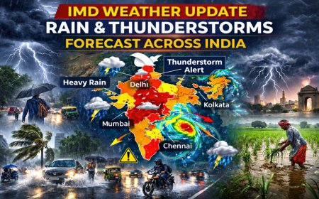
A shift in weather conditions across northern India brought light rain to the plains and fresh snowfall forecasts for the Himalayan region on Tuesday, as the India Meteorological Department (IMD) issued updated advisories linked to an active western disturbance. The latest weather bulletin indicates rainfall activity in Delhi and its neighbouring states, alongside snowfall in the higher elevations of Himachal Pradesh, Uttarakhand, and Jammu & Kashmir.
The change follows an unusually warm spell earlier this week that briefly pushed temperatures in the national capital above seasonal norms before cooler weather conditions returned under cloud cover.
IMD Forecast Signals Rainfall and Weather Alert Across Delhi NCR Region
Delhi and parts of the National Capital Region recorded light rain during the morning hours of 18 February after several days of elevated daytime temperatures. The IMD issued a yellow alert for changing weather conditions, warning of light rain, isolated thunderstorms and gusty winds reaching speeds of 30 to 40 kilometres per hour.
For 18 February, the IMD forecast the maximum temperature in Delhi at 27°C, while the minimum temperature was expected to settle near 14°C. The cloud cover and rain activity were projected to keep daytime readings slightly below the peak observed earlier in the week.
Neighbouring areas, including Noida, Gurugram and parts of western Uttar Pradesh, were also expected to experience similar weather patterns, with brief showers and lightning activity in isolated pockets.
Western Disturbance Drives Snowfall and Weather Activity in Himalayan States
The IMD attributed the evolving weather system to an active western disturbance moving across northwest India. Under its influence, light to moderate snowfall was forecast over the higher reaches of Himachal Pradesh, Uttarakhand and Jammu & Kashmir on 18 and 19 February.
Rainfall was also predicted in the lower hill districts, while Ladakh was expected to see snow in select areas. The department indicated that wind speeds in elevated regions could increase during the system’s peak phase, potentially affecting local transport in mountainous terrain.
Such weather disturbances are typical during late winter months, although the intensity and timing of recent systems have resulted in alternating warm and cool phases across northern India.
Temperature Swings Highlight February Weather Variability in Northern Plains
Earlier this week, Delhi recorded a maximum temperature of 31.6°C, marking one of the warmest February days in recent years. The spike drew attention to the unusual weather variability being observed this season.
Following the rainfall, maximum temperatures were projected to stabilise closer to seasonal averages. The IMD’s short-range weather outlook indicated that while a slight dip was expected immediately after the rain event, temperatures may gradually rise again over the coming days once cloud cover reduces.
Minimum temperatures, however, were not forecast to drop sharply. Night-time readings were expected to remain in the mid-teens, reflecting a transition phase between winter and early summer weather patterns in north India.
Meteorologists noted that fluctuating weather conditions in February are often influenced by successive western disturbances interacting with local atmospheric systems.
Thunderstorms, Lightning and Isolated Hail Form Part of Weather Advisory
Beyond Delhi, the IMD forecast isolated thunderstorms accompanied by lightning across parts of Haryana, Punjab and Rajasthan. Certain districts in eastern Rajasthan and adjoining areas were placed under caution for the possibility of isolated hail activity.
The advisory also included warnings for gusty surface winds during thunderstorm episodes. Such weather developments can temporarily disrupt traffic movement and outdoor activity, particularly in urban centres.
In addition, pockets of dense fog were forecast in eastern parts of the country during early morning hours, although northern plains were expected to remain largely clear outside rainfall windows.
Officials advised residents to monitor official weather updates and local advisories as the system progresses eastward.
Agriculture and Urban Mobility See Limited Weather Disruption So Far
Agricultural experts indicated that light rainfall during this stage of the rabi season could prove beneficial for standing wheat and mustard crops in parts of northwest India, provided precipitation remains moderate.
Urban mobility in Delhi experienced minor delays during peak commuting hours due to wet road conditions, but no major disruptions were reported. Authorities did not announce any large-scale precautionary closures.
The broader weather outlook suggests that while isolated rainfall activity may persist for another day in certain northern states, the system is expected to weaken gradually. Thereafter, drier weather conditions are likely to prevail across much of the region.
The IMD’s extended forecast indicates a gradual increase in maximum temperatures after 19 February, as cloud cover decreases and rainfall activity diminishes. However, additional western disturbances later in the month could once again alter the prevailing weather pattern.
For now, the combination of light rain in the plains and snowfall in the hills reflects a transitional February phase, where winter systems continue to influence northern India even as daytime warmth signals the approaching seasonal shift.

 Like
0
 Dislike
0
 Love
0
 Funny
0
 Angry
0
 Sad
0
Sad
0
 Wow
0
Wow
0


